
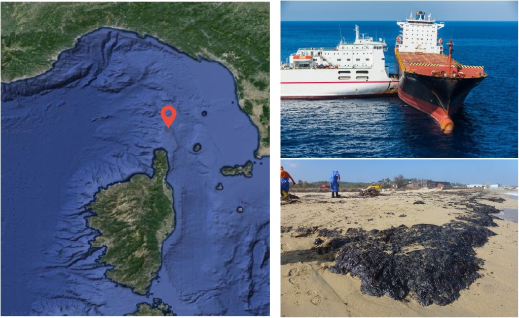
Over 2,000 oil spills were recorded in the Mediterranean between 2015 and 2017. How can operational monitoring and forecasting be improved to limit the environmental damage they cause?
A new study addresses this challenge by testing a comprehensive framework for predicting how oil spills move and evolve in the Mediterranean Sea, which is one of the world’s busiest and most vulnerable maritime regions.
🔗 Read full article in Marine Pollution Bulletin: https://doi.org/10.1016/j.marpolbul.2025.118574
Using multiple oceanographic models, and data from CMEMS, SHOM, IFREMER, ERA5 and MeteOcean, the research compares how different inputs (surface currents, Stokes drift and wind drag) influence oil dispersion. A real accident case was validated using Sentinel-1 satellite images.
Key insights:
- Stokes drift and wind play a major role in surface transport, improving trajectory forecasts when combined with currents.
- Different ocean and climate models produce substantial variability, highlighting the need for careful model selection or multi-model probabilistic approaches in operational forecasting.
With maritime transport and tanker traffic continuing to rise across the region, accurate and rapid oil spill prediction tools are essential for protecting Mediterranean ecosystems and guiding emergency response.
Cite as: Scotto, B. M., Lira-Loarca, A., Novellino, A., & Besio, G. (2026). Dispersion monitoring services in the Mediterranean Sea: A multi-model statistical approach. Marine Pollution Bulletin, 222, 118574. https://doi.org/10.1016/j.marpolbul.2025.118574
